Storm Antoni has been named by the Met Office with a low-pressure system set to bring strong winds and rain for many on Saturday.
From late Friday night and into Saturday, Storm Antoni will bring strong winds and a spell of heavy rain which has resulted in the issuing of weather warnings.
Northern Ireland will be the first to see the influence of this low-pressure system, with a warning for rain in force from the early hours of Saturday morning.
A further warning for wind has also been issued for southern and western parts of Wales, the southwest of England, as well as a large stretch of the south coast of England.
Met Office Chief Meteorologist Steve Willington said: “Storm Antoni will bring some potentially disruptive weather on Saturday as it moves from west to east. Northern Ireland is likely to see some of the highest rainfall totals, with 40-60mm falling in some spots, but 20-30 more widely. Away from the warning area many will still see a very wet day, especially in north Wales and north England.
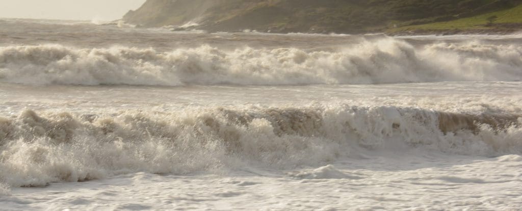
“Storm Antoni will also bring strong winds to a swathe of Wales, southwest England and southern coastal areas of England. The strongest winds will affect parts southwest England and southwest Wales where exposed coasts and high ground could see gusts in excess of 60mph. In these areas, gusts inland could reach 50-55mph for a time. These windy conditions will likely coincide with high tides which will present an additional challenge for coastal areas.
“Busy travel networks at this time of year and the possibility of people having made plans to be outside have resulted in the system meeting our criteria for naming, with a strong chance of disruption for those within the warning areas.”
Warnings highlight potential transport disruption and the chance of some power cuts occurring.
Travel disruption
The RAC’s Rod Dennis said: “We expect Saturday to be the worst day on the roads of the summer so far, especially for anyone in the southwest of England – and that’s a lot of people as our research shows it’s the most popular part of the country for leisure trips by car this year.
“Conditions will be atrocious with a wholly unpleasant mix of very strong winds and locally intense rainfall. The best advice is to slow down significantly to stay safe and avoid exposed moorland and coastal routes until the storm passes. Drivers towing caravans and trailers need to be particularly careful in these conditions and those with boxes and bikes on the roof should double-check they’re secured properly.
“Drivers should also watch out for fallen trees and be prepared for the disruption they cause.
“Nationally, we estimate around 4m drivers will be using the roads for leisure journeys across the whole weekend.”
Malcolm Bell, Executive Chair of Visit Cornwall said: “All campers should ask the campsite operator for advice and guidance on their equipment and location, to ensure they are best equipped to cope with the unseasonal gale force winds, and in some exceptional cases such as on very exposed sites that may mean packing away for the duration of the gales.”
Storm Antoni is the first storm named by the Met Office in this storm naming season, though the names Otto in February and Noa in April were adopted by the Met Office earlier this year as they were named by international partners and impacted the UK. Find out more about how storm naming works.
It’s quick and easy to check if your property is at risk of flooding. Just put your postcode in this flood risk checker to find out your risk.
Any sign of warmer weather?
After a month of largely unsettled weather for the UK, there are some tentative signs of a change, albeit perhaps only briefly, in the dominant weather pattern for the UK later next week.
Steve Willington explained: “For the latter half of next week, there are some signals of a shift in the jet stream which may allow for high pressure to build in for southern areas of the UK, increasing the likelihood of some drier weather for a time. However, at this range, the details are quite uncertain and there’s still a chance of some rain for areas further north. As always, details will become clearer with a shorter lead time.”
You can check the latest forecast on our website, by following us on Twitter and Facebook, as well as on our mobile app which is available for iPhone from the App store and for Android from the Google Play store. Keep track of current weather warnings on the weather warning page.
One partner. No competitors. Full visibility across the region.


