The Major Emergency Scheme is likely to be called at 06:00hrs 30 December 2015 and the Council Emergency Centre will be activated at that time.
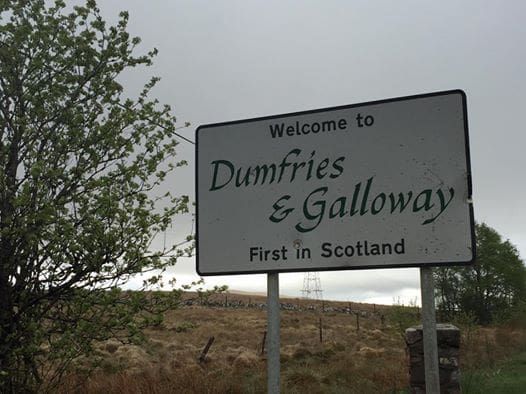
A Flood Alert has been issued for Dumfries and Galloway.
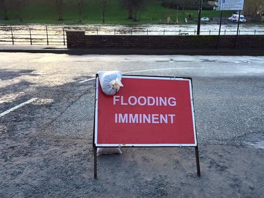
The flood risk is MEDIUM on Wednesday and Thursday. SIGNIFICANT disruption due to river flooding is likely, and SEVERE disruption is possible.
Heavy rainfall is expected from Tuesday night into Wednesday, which will lead to a risk of flooding to land and property from rivers. This may also result in widespread disruption to travel and infrastructure.
In addition, due to a large storm surge combined with strong southerly winds and large waves there is a risk of flooding from waves and spray overtopping in exposed coastal areas. The greatest risk is at around the time of high water on Wednesday at 01:45hrs and 1500hrs along the Galloway Coast.
Weather Warnings
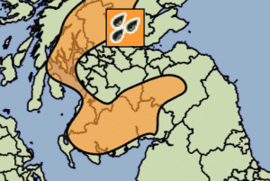
The Met Office have issued an Amber Warning of Rain at 12:00 on Sun, 27th Dec 2015; updated at 11:36 on Tue, 29th Dec 2015.
Valid from 00:15 on Wed, 30th Dec 2015 until 15:00 on Wed, 30th Dec 2015
Rain will be heavy and persistent for much of Wednesday with some large rainfall totals building up, particularly over south facing hills, and accompanied by southerly gales. Please be prepared for both surface water and river flooding.
 Amber alert for Rain
Chief Forecasters Assessment: A waving cold front is expected to become slow moving over western Britain during Tuesday evening onwards into Wednesday, associated with a strong, moist southwesterly airflow. Rainfall accumulations through this period are expected to be widely 20-40 mm, with 80 mm over some higher ground within the area, and the potential for some exposed locations in southwest Scotland to receive in excess of 120 mm.
A number of areas in Dumfries and Galloway are forecast to have almost 100mm of rainfall in the 12 hour period from midnight tonight.
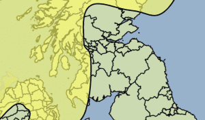
The Met Office have issued a Yellow Warning of Wind at 13:59 on Fri, 25th Dec 2015; updated by at 05:01 on Tue, 29th Dec 2015
Valid from 15:00 on Tue, 29th Dec 2015 until 08:00 on Wed, 30th Dec 2015
A rapidly deepening area of low pressure, passing to the west of Ireland and Scotland, is likely to bring a swathe of gale and severe gale force winds across parts of Northern Ireland and Scotland later on Tuesday and at first on Wednesday.
Within Dumfries and Galloway this yellow alert covers the area to the west of Creetown.
 – Yellow alert for Wind
Large waves are also expected to affect coastal areas in the west during Tuesday evening and overnight into Wednesday.
Flood Warning
Flood Guidance Statement – 10:30hrs, 29 December 2015
The flood risk is MEDIUM on Wednesday and Thursday. SIGNIFICANT disruption due to river flooding is likely, and SEVERE disruption is possible.
Rivers Flood Risk
On Wednesday, SIGNIFICANT disruption due to river flooding is likely and SEVERE disruption is possible, particularly in Dumfries & Galloway, but also western parts of Scottish Borders, and across large parts of western and central Scotland, as highlighted in amber. There could be flooding affecting parts of communities and widespread disruption to travel and infrastructure. The river flood risk in these areas is MEDIUM.
Coastal / Tidal Flood Risk
The coastal flood risk is currently VERY LOW.
On Tuesday night into Wednesday a large surge on the west coast combined with strong southerly winds and large waves may cause some flooding in exposed coastal areas including the northern islands. Localised and minor disruption due to coastal flooding is possible.
A further update will be received later in the afternoon from the Scottish Flood Forecasting Service (SEPA and Met Office)
Local Adverse Weather Impacts / Predicted Impacts
The following predicted impacts are based on information supplied by SEPA in a telephone discussion held at 11:30hrs 29 December 2015
River Cree (Newton Stewart).
Current model runs indicate that flows are likely to be similar to those experienced in November 2012, where property flooding on the west side of the river occurred. The peak is predicted to occur between 08:00 and 12:00hrs 30 December 2015.
SGN (gas) are putting in place measures to ensure supplies remain unaffected. British Telecom are putting in place measures to protect apparatus on the riverside.
The Riverside car park will be closed; the Sparling footbridge will be closed; Riverside Road will be closed.

The Flood Trailer will be located at the MacMillian Hall.
 It is likely that evacuations from low-lying properties will be required and a rest centre will be established at the MacMillan Hall or Douglas Ewart Secondary School as necessary.
Low-lying areas of Creetown are likely to see flooding impacts given combination of high river flows and coastal storm surge tidal events.
River Dee / Loch Ken
Given presence of Galloway Hydro Scheme, predicting the peak flows on this river system is difficult. However, given the highest rainfall totals will be seen over this area, vulnerable communities e.g. Carsphairn and New Galloway are being contacted directly. Contact being maintained with Scottish Power to ensure understanding of when roads liable to flooding will be impacted.
River Nith and Whitesands
The Whitesands is likely to see an event in excess of that experienced in 2009 with flooding impacts into the Vennel and Nith Place. Properties at Dock Park will also be impacted. Peak will occur between 09:00 and 11:00hrs although this may be extended by a storm surge tidal event. Car parks will be shut from 18:00hrs 29 December 15. Road closures will be effected when levels dictate, although likely to be early morning 30 December 15, Devorgilla Bridge will also be closed.
A rest centre will be established a Dumfries town centre location should evacuation of Whitesands properties be required.
Coastal flooding impacts will be realised at coastal communities at Carsethorn, Glencaple and Kingholm Quay.
The Flood Pod will be mobilised to the north end of the Whitesands at the public toilets.
River Annan
The River Annan is predicted to peak at a similar level as that experienced on the weekend of 5-6 December 2015. This will see communities at Heck, Hightae and Greenhills cut-off from public road network. The A709 at Shillahill Bridge will be closed when levels dictate.
River Esk (Langholm)
Flows in the River Esk are not expected to reach levels experienced on the 5-6 December 2015; levels are more likely to similar to that experienced on 26 December 2015.
Coastal Impacts
Due to a large surge combined with strong southerly winds and large waves there is a risk of flooding from waves and spray overtopping in exposed coastal areas. The greatest risk is at around the time of high water on Wednesday at 01:45 and 15:00 along the Galloway Coast.
Travel
The B7068 Lockerbie to Langholm road remains closed at Grange Quarry following a flood damaged bridge.
Bus services will be impacted by road closures of the Whitesands and the A709 at Shillahill Bridge.
Ferry services from Cairnryan to Northern Ireland are likely to be affected by the high winds later tonight and into Wednesday. Travellers are recommended to contact the ferry companies directly.
Communications
Contact has been made with the Council’s call centre to alert them to the situation and to make them aware of the possible surge in phone calls. Arrangements are being put in place so that the call centre and the response teams are aware of the calls and requests being made from the public.
Community Councils and Community Resilience Groups are being actively contacted by Council officers advising them of the likely impacts of the rainfall and flooding. As further information becomes available, communities will be updated.
Public messages from Police Scotland, Scottish Fire and Rescue Service and Dumfries and Galloway Council will be issued via normal communication channels e.g. press releases, social media.
A Council-led Information Cell to gather intelligence from communities will be established at 06:00hrs on 30 December 2015 in the Council Emergency Centre
One partner. No competitors. Full visibility across the region.