Storm Bella has officially been named as strong winds and heavy rain are forecast from 26 December
After a relativity calm and cold day on Christmas Day, conditions across the UK will turn increasingly unsettled through Saturday 26 December and into the 27December with strengthening winds and heavy rain moving in from the north.
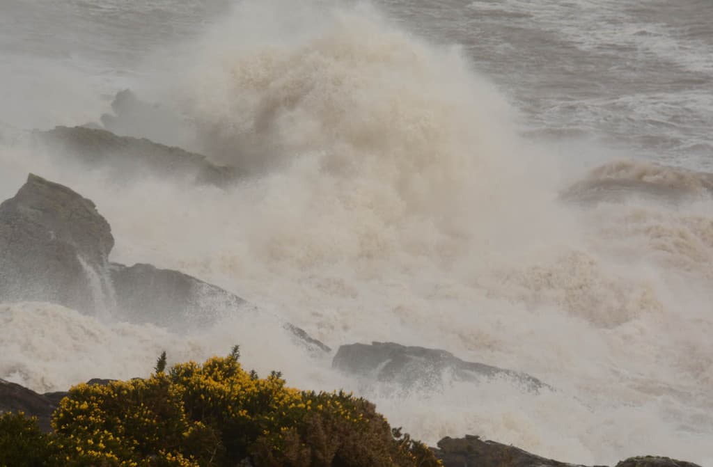
An Amber national severe weather warning has been issued for parts of south Wales and across southern England, with gusts expected to reach up to 60-70mph in exposed coastal locations.
A Yellow warning for wind for the whole of England and Wales as well as the far south of Scotland has also been issued and will be in force from 15:00 on 26 December to 12:00 on 27 December.
The strong south-westerly winds will develop across parts of northern England and the far south of Scotland on Saturday afternoon, before transferring south-eastwards across the rest of England and Wales into Sunday morning, clearing by early Sunday afternoon.
Inland gusts of 50-60 mph are likely, with the potential for 60-70 mph in some locations. Hills and coasts exposed to the south-westerly winds could see gusts of 70-80 mph.
In addition to the strong winds, a period of heavy, squally rain will affect western and southern areas. A Yellow warning for rain has been issued for parts of Scotland, Wales and much of north and south west England, particularly where there has already been flooding from recent heavy rain. Combined with strong winds, the rain will lead to some hazardous travelling conditions.
Deputy Chief Meteorologist Tony Wardle, said: “Conditions will turn very unsettled after Christmas day, with a large area of low pressure sweeping across the UK from Boxing Day. Very strong winds will impact much of England and Wales, with particularly strong gusts on south west facing coasts.
“Heavy rain will also move in from the north, with heavy downpours through the afternoon in Scotland and Northern Ireland moving south across England and Wales overnight. This will be a notable change from the calmer conditions over Christmas Eve and Christmas Day so take extra care and stay up to date with the latest forecast.”
The strongest winds and heaviest rain will ease from the northwest on Sunday afternoon although conditions will remain blustery with showers in the west and some of these turning to snow in northwest Scotland. With cold air feeding in from the north, there is the continued chance of wintry precipitation through Monday and Tuesday, particularly over high ground in the north of the UK.
For Christmas Day itself, a ridge of higher pressure will keep conditions more settled. Some showers will affect eastern England early in the day with a possibility of the odd flake of snow, technically making it a white Christmas, however it is not expected to settle. Additionally, showers moving into Scotland could fall as snow over 300m in the Grampians.
In the run up to, and during the Christmas period keep up to date with the latest forecast for your area using our forecast pages and by following us on Twitter and Facebook, as well as using our mobile app which is available for iPhone from the App store and for Android from the Google Play store.
One partner. No competitors. Full visibility across the region.


