With the continued weather warning (Yellow) across Dumfries and Galloway from the Met Office for Thursday and Friday stating Ice and snow likely to bring travel disruption over parts of Scotland and England, staying cold over the next few days with showers or longer spells of rain, sleet and snow for most.
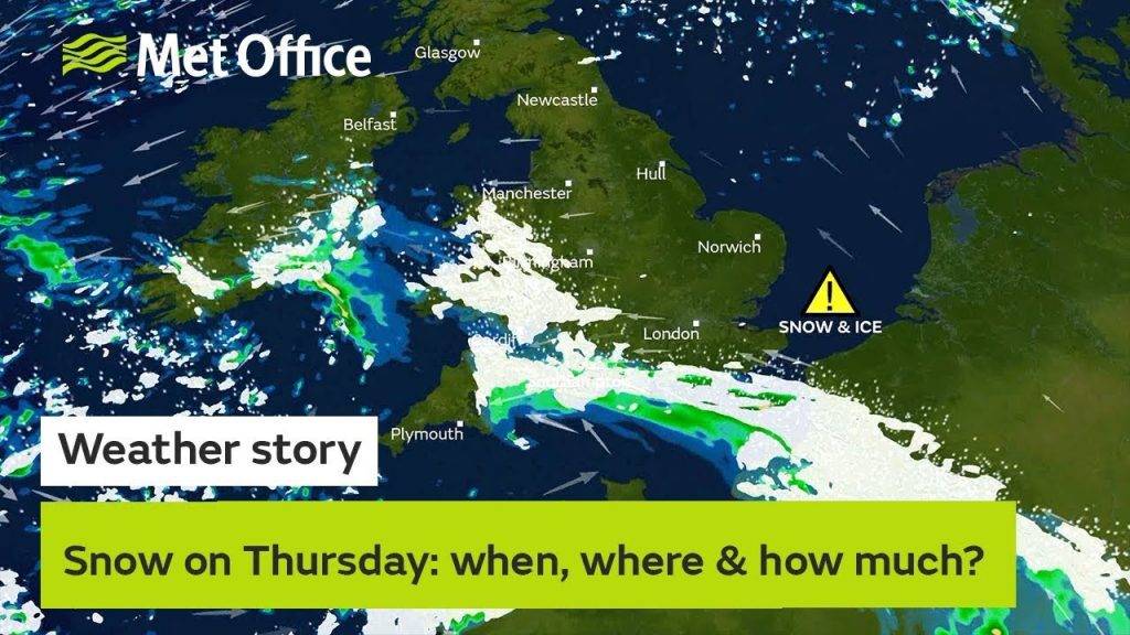
Ice warnings have been issued for northern and western parts of the UK for Wednesday night. Warnings for snow and ice have been issued for many parts of the UK on Thursday and Friday.
Many have seen wintry showers today (Wednesday) with the snow impacting airports in northwest England and Scotland and Ireland. A widespread frost is expected tonight.
A snow and ice warning has been issued for the southern half of the UK from Thursday afternoon and into Friday. Rain and snow will move into the UK from southwest, perhaps persisting across some southern areas on Friday. The timing of rain and snow clearing on Friday is currently uncertain.
Chief Meteorologist Steve Ramsdale said: “Areas could see rain and snow for periods of 6 to 9 hours, with 1–3 cms of snow gathering in places within the warning area and the potential for 5-10 cm, perhaps most likely in the South West and over Wales. Snow amounts will vary with many places seeing very little.”
Staying cold and brighter further north with wintry showers in the north and east bringing a risk of ice and some snow in places. A snow and ice warning has been issued for northern and eastern parts of Scotland and England for Thursday night and into Friday.
Richard Leonard, Head of Road Safety said: “Gritters will be out treating our roads around the clock, but it is still important to drive to the conditions when snow is forecast.
“Keep your distance and reduce your speed, because even in conditions that seem normal, and where the snow is not settling, it can be slippery if ice patches have formed, or where fresh grit has not been worked into the carriageway.
“Drivers should plan their journeys, monitor weather reports and pack a snow kit of blankets, food, water and a shovel.”
Staying cold into the weekend with wintry showers, particularly in the north and east of the UK. Further warnings of snow and ice may be required. During Sunday and Monday bands of rain and snow look likely to arrive from the west. However, confidence in timings and if any areas will see impacts is low at this stage.
You can find out the current forecast in your area using our forecast pages and by following us on Twitter and Facebook, as well as using our mobile app which is available for iPhone from the App store and for Android from the Google Play store.
One partner. No competitors. Full visibility across the region.